Come and try orienteering alongside Hadrian’s Wall in a small country park not previously used for an orienteering event.
Venue, travel and parking: Walltown Quarry Country Park is located in Northumberland National Park just off the B6318 Military Road near Greenhead: OS grid reference NY668659, what3words – awesome.smile.pelt. The postcode is quoted as CA8 7HF but this is imprecise and unlikely to be of use in a satnav.
Parking is all hard standing. Please park carefully, watching for runners that may be passing through or adjacent to the car park, and do not obstruct where buses need to pass through and stop. Parking is usually pay and display; we have negotiated free parking for orienteers with the National Park – you should received a small ticket to put in your windscreen from a parking helper. Please do not park on the narrow road outside of the entrance, nor park in the Roman Army Museum nearby.
You could be intrepid and travel to Walltown Quarry by bus. From Hexham the AD122 bus service provided by GO North East appears to run every 2 hours. From Carlisle there is a Reays bus service to Walltown currently operating 7 days a week, timetable here.
Border Liners will be using a cabin located a short walk from the car park as our event base. Look out for the BL feather flag which will be placed within sight of the car park. The visitor centre in the car park, which provides information about the country park, may or may not be open on the day.
Terrain: Walltown Quarry Country Park, on Hadrian’s Wall, is an old quarry which has been transformed into a compact country park. There is an extensive trail network, interspersed with some deciduous woodland planting, dense in many places, and rough open grassland. The rough open will be fairly easy to progress through, some of the wooded areas may require a bit more determination but it’s never far to go around. The national park has been adding accessible trails throughout the park with many of the paths providing good footing.
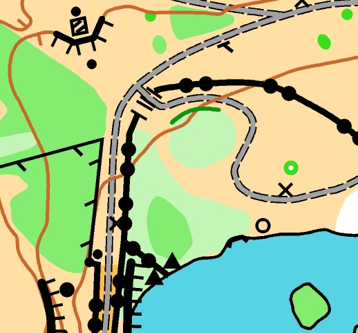
Courses: Long (3.6km, map flip), Medium (2.2km), Short (Yellow standard; 1.4km). The short course is definitely suitable for beginners. Whilst long and medium courses do not seem that long, both of these courses are more technical in nature with off-path controls and route choice. Expect all courses to have some climb.
Entries: Online entry available now on SiEntries until Thursday 22nd October 23:59. Entry fees £7 senior, £3 junior & full-time students. There will be some on-the-day entry available on all courses.
Map: New geo-referenced map by Keith Tonkin with Lidar contours. Scale 1:2500, 5m contours, A4 printed by BL on waterproof paper. Control descriptions on the map only.
Start Times: 11:00 – 12:00
Refreshments: We plan to offer tea/coffee in the cabin. Please bring your own mug. The visitor centre may or may not be open (it closes for the winter around mid-October).
Toilets: Public toilets in the car park on the outside of the visitor centre.
Dogs: Allowed on leads.
Safety and Risk: A comprehensive risk assessment has been prepared by the organiser. Participants must download even if they retire so we can be sure everyone is back and that we do not need to start a search and rescue. Participants take part at their own risk and are responsible for their own safety during the event.
Specific to this event, please do not under any circumstances go into the quarry lake, and do not cross any fences or walls. Be aware of moving vehicles should your course cross through the car park.
Note about Insurance
If you are not a member of British Orienteering please read the important note regarding public liability insurance here
Officials: Organiser – Anita Laird, Planner – Tricia Davies.
Acknowledgements: Walltown Quarry Country Park is owned and managed by Northumberland National Park. We are grateful to them for granting permission to hold the event. We would also like to thank our neighbours NATO; many years ago they created a small permanent course here and we are grateful to them for allowing us to update their map and hold this event.
Historical information: Walltown Quarry, established in 1876, was once the largest ‘whinstone quarry’ on Hadrian’s Wall and produced huge quantities of road chippings. The ‘whinstone’ at Walltown is part of a series of huge sheets of dolerite which underlie large parts of northeast England and known collectively as the Whin Sill. This same rock outcrops east of here in a ridge extending to Sewingshields Crag, then again at Craster, Bamburgh and the Farne Islands; and to the south at High Cup Nick and High Force in County Durham. The old quarry has since been transformed into a compact country park of trees, wildflowers, and wildlife. The park lies within Northumberland National Park and needless to say from it’s name you can probably guess that Hadrian’s Wall passes through the park. The Pennine Way national trail also passes through the park.
After you have ran you could take a walk up through the country park onto Hadrian’s Wall and admire the views to the North and East. Alternatively have a wander around and find some of the permanent control marker posts; we will print a few maps of this in case anyone is especially keen.
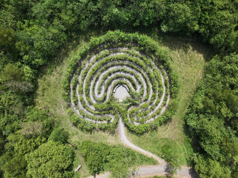
The Country Park holds a Peace Labyrinth, constructed with more than one thousand willows in 20 different colours planted in 2011. It is marked on the map so by all means take a walk around it once you have ran.
Nearby is the Roman Army Museum and Magna (Carvoran) Roman Fort, open 9:30am – 5:30pm each day, where you can “experience the edge of the empire”.

