09/10/2026 – Preliminary details and entries open
Entries
Online for all courses at: https://www.sientries.co.uk/event/bl-eycott-hill-galoppen-2026. You can also view the entries list here. Limited entry on the day for yellow, orange and score courses (£1 surcharge for Seniors M/W 21+).
> Junior/Student (M/W 20 and younger, plus full-time students) £4.00
> Senior (M/W 21 and older) £9.00
> Extra Maps: £1
Groups and Pairs / Extra Maps
If you would like to go round as a group or in a pair, just enter one person and use the option to select any additional maps that your group would like at £1 each.
Entries close 23:59 Wednesday 28 October 2026.
Inclusivity
If you need any special adjustments to enable you to attend this event, please contact the Organiser in advance: berryisabel@yahoo.co.uk This might include:
> a quiet parking area
> a quiet start either earlier or later than the advertised times
> parking/drop off close to the start
> a chance to look at the course map before starting
> a map at an extra large scale.
Due to the nature of orienteering, we may not always be able to support every special adjustment, but we’d rather you asked us, so we can see what we can do. For further information: https://borderlinersorienteering.org/inclusivity/
If you are a not a member of British Orienteering you should read this important note regarding public liability insurance before you enter the event: https://borderlinersorienteering.org/british-orienteering-public-liability-insurance/
Parking, Registration and Download
Will all be at this location:
Grid Ref: NY394301
Postcode of nearest dwelling: CA11 0XD
What3Words: https://w3w.co/lawyer.dishing.surfacing
There will not be any direction signs to the event. The Border Liners flag will be flying to mark registration.
Parking on the roadside verge in either direction from the car park, ensuring clear access for all field gateways, as directed by BL volunteers on the day. We strongly encourage you to car share, in order to keep the number of cars parked along the verge as low as we can manage and therefore minimise any potential impact on the local community. Please leave the Cumbria Wildlife Trust car park free for members of the public who may be visiting Eycott Hill on the day.
You can access the event by public transport and a walk:
Nearest bus stop is The Sportsman’s Arms, on the X4/X5 route between Penrith and Keswick: https://www.stagecoachbus.com/timetables Then approx 3km, 50m ascent.
There are bike racks in the Cumbria Wildlife Trust car park.
If you are a Border Liners member, you can arrange car share via the Border Liners WhatsApp group. To be added to this group, contact: paulwatson_BL@outlook.com
Toilets
A portaloo will be available in the Cumbria Wildlife Trust car park.
Dibbers
Can be borrowed, free of charge, at registration. If you have your own dibber, you do not need to visit registration before heading to the start.
Dogs
Not allowed on any of the courses.
Public
Eycott Hill is a popular nature reserve and you may encounter members of the public while out on your course. Please give way to them at any pinch point.
Whistles and Clothing
It is extremely strongly recommended that competitors carry a whistle. Eycott Hill is an exposed area and previous events have experienced some very wet and very windy weather. In wind and/or rain, competitors are strongly advised to wear a waterproof jacket – which may be made compulsory on the day if conditions are poor – and other warm clothing.
First Aid/Medical
At registration/download. If you have a medical condition which you would like the Organiser to be aware of, please contact in advance berryisabel@yahoo.co.uk or inform at registration. The risk assessment will be held at registration/download. Please check yourself for ticks after your run.
Refreshments
La’al Yan coffee van and Binsey Field Kitchen will be present, serving hot drinks, cakes and food.
Start/Finish
Start: 200m with 20m descent to the start, on a grassy track. Finish: approximately 700m, 30m ascent back to Registration/Download, also on a grassy track.
Starts 1030-1230
Courses close 1430
Courses – Provisional details
| Course | Length (km) | Climb (m) | Ideally suited for… |
| Brown (double sided map) | 9.2 | 300 | Experienced orienteers wanting the highest level of navigational and physical challenge |
| Blue (double sided map) | 6.1 | 165 | |
| Green | 4.2 | 125 | |
| Short Green | 3.4 | 85 | Experienced orienteers wanting the highest level navigational challenge, over a shorter distance |
| Very Short Green* | 2.4 | 50 | |
| Light Green | 3.4 | 70 | Orienteers with some existing experience who are fairly comfortable using a compass and confident away from paths and line features |
| Orange | TBC | TBC | Adult newcomers, or children and families with some experience, looking to extend their skills |
| Yellow | 2.2 | 65 | Newcomers, children and families – great for building experience and learning skills |
| 60 minute score | Those wanting a flexible challenge; a mix of harder and easier controls: You choose your route and how far you go; ensure you are back at the Finish by 60 minutes. 20 controls. Each control worth 10 points. Lose 1 point for every 20 seconds you are late. | ||
* VERY SHORT GREEN – this is the same course as the Short Green but with some controls missed out. If you want to do Very Short Green, enter Short Green and pick up a Short Green map at the start. The map will show which controls to miss. You can decide while on the course whether or not to take the Very Short Green cut-off. The download system will work out which course you have completed.
There will be loose control descriptions.
Terrain, Mapping and Safety Notes
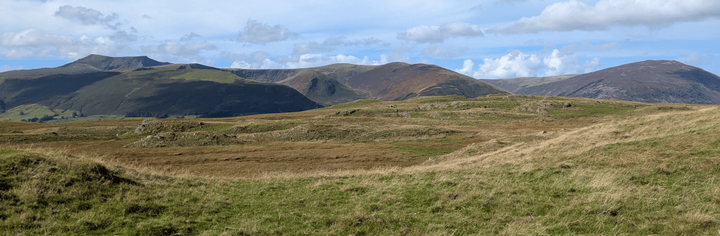
Eycott Hill is open fell. There are a few paths – a mix of grassy tracks and rougher tracks. Some areas on the longer courses cross areas which have quite a few cow hoof holes over them, creating a rough surface. Underfoot is mostly grass, ranging from short cropped to longer and rougher, particularly in wetter areas.
> Scale 1:7,500 for all courses.
> Contours 5m
> Rough open is mapped in white, rather than the usual pale yellow.
> Out of bounds marshes: The out of bounds overlay has been added to areas of marsh mapped as uncrossable. Do not attempt to cross these at any time; they are deep and may contain hidden pools and/or flora and fauna of scientific interest.
> Paths: There various unmapped trods and quad bike tracks. Some of the mapped paths in the middle of the area are intermittent, fading in and out over time and on the ground.
> Yellow and Orange: The Yellow course will follow a section of tapes where the path is indistinct. Orange course competitors may encounter these tapes, depending on route choice.
> Cows: There are Belted Galloway cattle grazing this area and some may have calves. The cattle are docile and used to people, but please run around them, giving a wide berth, if you encounter any along your route.
> Walls and fences: Do not cross any wall or fence, except at marked crossing points, which will be taped. To aid clarity, purple uncrossable markings along walls and fences have not been used.
For any queries on this event, please contact: Isabel Berry berryisabel@yahoo.co.uk
Planner: Jeff Powell Davies
Organiser: Isabel Berry
Controller: Owain Rice
For information about Border Liners Data Privacy, Photography and Safeguarding policies see: https://borderlinersorienteering.org/club-info/privacy-and-data-protection/ and https://borderlinersorienteering.org/safeguarding-safetyx/

