Sunday 6 April 2025
(Updated April 1st:
Important clarification of event centre location and travel directions to find it
Coffee Van with hot drinks, delicious cakes and hotdogs
Brown and Blue have map turnover
Dog rules clarification
Final course length/climb)
Parking: at Drybarrows Farm, Winder Hill, by kind permission of Mr D Thompson
Closest Postcode: CA10 2RA – NB this postcode will direct you approx. 1km from the event location up a private farm drive – please avoid this, follow event signs and not your satnav.
Grid Ref: NY 501 172
W3W: ///gearing.birds.worms
Please note the event centre location is at Drybarrows Farm – keep following your nose (and the orienteering signs) all the way to the end of the lane. The road is very narrow and there are few passing places – be prepared to reverse if necessary and in particular to give way to local farmers. (See information about parking for larger vehicles below)

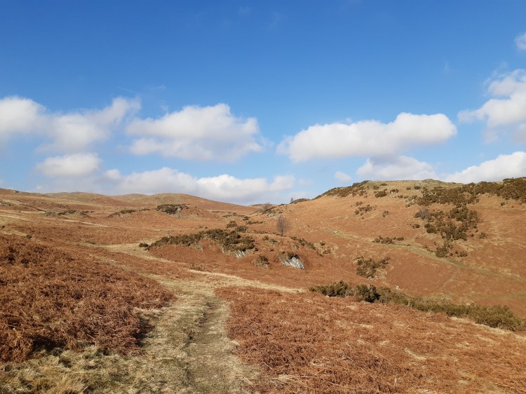
Terrain: Classic open Lakeland fell, situated to the north of Haweswater. Open runnable terrain with usual features of grassland, marshes, crags and intricate contour detail. A map from a previous event can be found on Routegadget here
Directions:
Approaching from Bampton, take the unsigned minor road south past The Mardale Inn at St Patrick’s Well. After 800m, at the cross-roads, turn right (heading west) towards Hungerhill. Follow the road for 1.8km to find the parking field at the end of the road. There will be an orienteering sign at the crossroads (W3W ///merit.look.aliens).
From Shap, follow the minor road to Bampton Grange. After crossing the bridge turn left (W3W ///rents.fillings.rocker) and then first right (W3W ///ironic.pokes.activates) to arrive at the crossroads (W3W ///merit.look.aliens). Straight over the crossroads (heading west, signed as a dead-end) towards Hungerhill. Follow the road for 1.8km to find the parking field at the end of the road. There will be an orienteering sign at the crossroads (W3W ///merit.look.aliens).
Take care at the crossroads as visibility is poor.
Larger Vehicles: The road west from the crossroads (W3W ///merit.look.aliens) is steep and narrow. It is unsuitable for vehicles wider than approx. 2.2m. Alternative parking is availabl. At the crossroads take the road heading north east. After 150m there is a large layby area on the right, just before the river (W3W ///heightens.petition.severe). This parking will not be signed / marshalled.
Car Parking: Grass field, £2 fee – please bring the correct change.
Please follow parking marshals’ instructions.
Food. We are very pleased that Yasmin is bringing her “L’al Yan Coffee” van and will be serving hot drinks, delicious cakes and hotdogs. Cards are accepted but you will no doubt help the queue if you have cash available.
Toilets: At car parking field/assembly.
Starts: 10:30 – 12:30
Route to the Start: The walk to the start from the car parking field/assembly is approx. 700m with around 40m climb. Please follow marshal’s instructions and signs from the field gateway. Please close the fell gate behind you.
Clothing Dump. Clothing may be left near the start. A location will be signed. All clothing is left at your own risk.
Results will be displayed at download and available via the Border Liners website as soon as possible after the event. www.borderlinersorienteering.org
Finish: Courses close at 14:30. Located close to the start. Use the same route you took to the start to return via the clothing dump to download and the assembly area. Please ensure you download, even if you retire.
Pre-entry: Now closed. Entry list here
Entry on the day: for the Yellow and Orange courses only subject to map availability (Senior £11, Junior £4, extra maps £1.00)
Maps: 1:10000 for Brown and Blue. 1:7500 for all other courses.
Rough open is shown as white. Walled fields are shown on the map as fast open in yellow/orange, but no courses go into these fields. Accordingly, walls must not be climbed. Be prepared for unmapped quad bike tracks and sheep trods.
Copies of Yellow maps will be available at registration should anyone wish to have a look at the course in advance.
Control Descriptions: Loose in start lanes and on the maps.
Timing: Sportident – Controls will be SIAC Enabled with punching start and finish.
Dibber Hire: Free but £30 payable if lost. Collect pre-ordered dibbers from Download on the day. Also available for entry-on-the day.
Safety:
- Clothing: Shorts are allowed, but competitors should be tick-aware and thoroughly check after the event.
- Weather: Please take appropriate precautions, hydration, sunscreen and head cover. If you want to take water to the start a bin liner will be provided at the start for the disposal of plastic bottles. Water for emergency use will be available at the finish.
- Cagoules: The area is exposed and if cagoules are compulsory, competitors will be advised in the final details and/or by signage in the field.
- Whistles: are compulsory.
- Animals: There may be grazing animals (sheep / cows / horses) in the area. Please do not run directly at any animal.
- Ticks: Although early in the year, animals graze the area, therefore runners should check for ticks following their run.
- First Aid. A first aid kit will be located at the finish and at Registration.
- Known Medical Conditions: Runners with a known medical condition which could affect them during the event are asked to leave details in a sealed envelope at registration. The envelope will be destroyed after the event. Details may also be provided via SI Entries.
- Defibrillator: The nearest defibrillator is located at Bampton Valley Stores, Norbrock House, Bampton, Penrith CA10 2RQ. What 3 Words: ///freezers.solve.volcano.
- Behaviour: Other members of the public and the farmers may be in the competition area. Please be mindful and cheery as we are grateful to them for allowing us to use their land.
Dogs: Must be on leads (no exceptions, it is lambing season and there will be sheep nearby) in Car Parking area only please. No dogs on the competition area.
Courses:
| Course | Technical difficulty | Course length | Climb |
| Yellow | TD2 | 2.3km | 90m |
| Orange | TD3 | 3.0km | 110m |
| Light Green | TD4 | 3.4km | 160m |
| Short Green (and Very Short Green*) | TD5 | 3.5km (2.3km) | 160m (100m) |
| Green | TD5 | 4.3km | 210m |
| Blue | TD5 | 6.2km | 260m |
| Brown | TD5 | 9.2km | 380m |
*VERY SHORT GREEN – this is the same course as the Short Green but with some of the higher controls in the middle of the course missed out, with the aim of reducing the physical difficulty of the course. If you want to do Very Short Green, enter Short Green and pick up a Short Green map at the start. The map will show which controls to miss. You can decide while on the course whether or not to take the Very Short Green cut-off. The download system will work out which course you have completed.
COURSES CLOSE AT 2.30PM. PLEASE REPORT TO DOWNLOAD AT CAR PARK/ASSEMBLY EVEN IF YOU DO NOT COMPLETE YOUR COURSE
Nearest A & E
Cumberland Infirmary
Newtown Road
Carlisle
CA2 7HY
NY 387 561
W3W: ///cool.pines.tribune
Urgent Treatment Centre
Penrith Community Hospital
Bridge Lane
Penrith
CA11 8HX
Open 8am – 10pm daily. NB X-Ray dept is not open at weekends.
W3W: ///ponies.struts.intrigued
Officials:
Organiser – Ali Lea (BL) (contact via https://borderlinersorienteering.org/club-info/contact/)
Planners – Karen and Dan Parker, Richard Evans (BL)
Controller – Steve Birkinshaw (WCOC)
Borderliners Orienteering Club would like to thank United Utilities and Lowther Estates for access permissions, and Mr D Thompson for the kind permission to use his field for parking.
